
GNSS Modules
Cost-effective dual-band and high-performance multi-band modules, with firmware from single-point and raw observables to integrated INS.
GM111GM511GM523GM512A
GNSS · IMU · RTK corrections · Algorithms
Built on proven mass-production positioning technology, we close the loop between satellite-inertial hardware, high-precision algorithms and correction data — one complete solution that brings accuracy to the centimeter level and time-to-fix down to seconds.
Product families
Self-developed GNSS and IMU products at the core, completed by terminals, correction services and algorithms — available as individual components or as a full solution.
Cost-effective dual-band and high-performance multi-band modules, with firmware from single-point and raw observables to integrated INS.
Automotive-grade 6DoF inertial modules, factory-calibrated across the full temperature range.
GNSS/INS integrated navigation terminals — GNSS, IMU and RTK in one unit, in value, high-performance and professional survey editions.
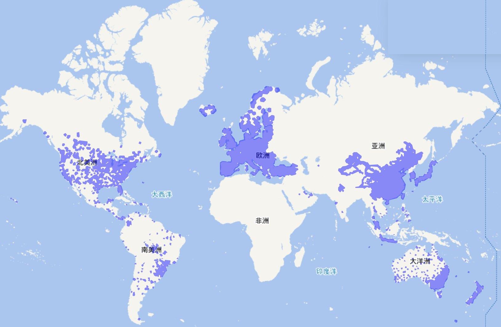
Centimeter-level correction data across China, Europe and North America.
GNSS/INS tight-coupling algorithms for L4 low-speed autonomy, with over-the-air updates.
GNSS modules
Dual-band GM111 for cost-sensitive designs; multi-band GM511, GM523 and GM512A for high performance, dual-antenna heading and automotive integration.
GM512A
Multi-band · automotive-grade
Scores compare the four modules with each other, based on their datasheets. Hover a module to see its specs, or an axis to compare all four.
IMU modules
IB601A and IB611A are 6DoF IMU modules built on a high-performance integrated IMU chip, factory-calibrated across the full temperature range.
| IB601A | IB611A | |
|---|---|---|
| Gyroscope | ±300°/s · bias instability 0.6°/h · ARW 0.04°/√h | |
| Full-temperature bias | 0.02°/s gyro · 2 mg accelerometer | |
| Accelerometer | ±8 g · bias instability 30 μg · VRW 0.04 m/s/√h | |
| Output rate | Up to 200Hz | |
| Environment | Automotive-grade, –40 to 105 °C | |
| Housing | Metal housing, floating connector, under 14 g | |
| Interfaces | SPI | UART + SPI |
Positioning terminals
GNSS/INS integrated navigation
Single- or dual-antenna terminals in three editions — from volume vehicle programs to ground-truth survey systems.
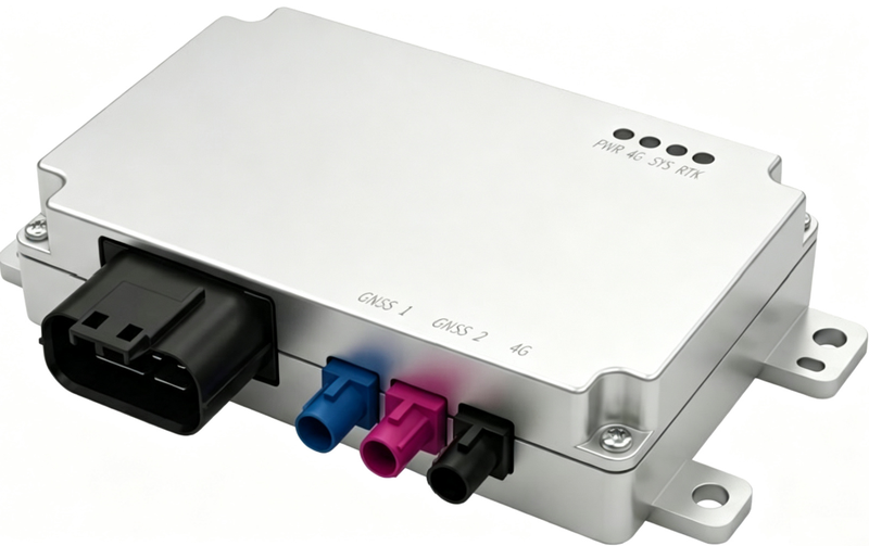
Value edition
Near-OE, commercial and low-speed autonomous vehicles
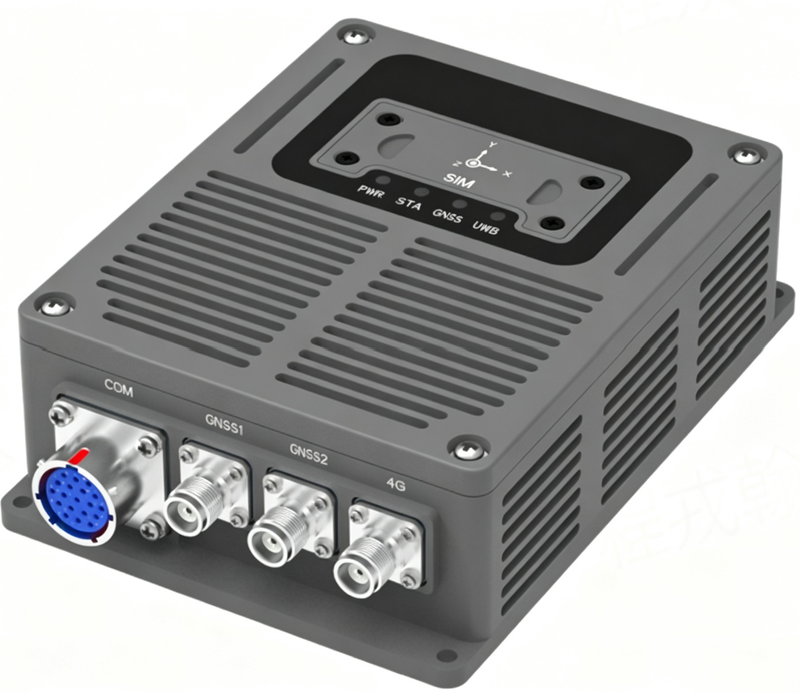
High-performance edition
Aftermarket applications that need high reliability
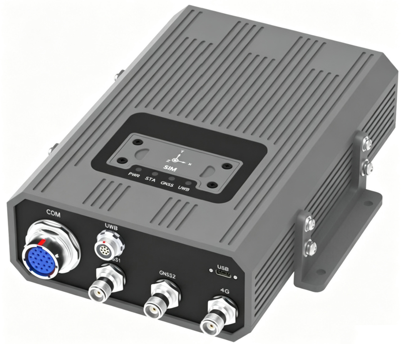
Professional survey edition
Survey and ground-truth reference systems
Global correction services
N-RTK and PPP-RTK services covering China, Europe and North America. Correction data is stored, computed and broadcast from the cloud, then combined on the device with GNSS tracking the same constellations as the reference stations, an IMU tier matched to the application, and standard or custom positioning algorithms — closing the loop to centimeter-level absolute positioning.
Redundant by design: dual receivers at every reference station, dual data-center links and dual communication paths. Supports ITRF2014, CGCS2000 and WGS84. The service holds a Class-A surveying & mapping qualification and MLPS Level 3 cybersecurity protection.
Applications